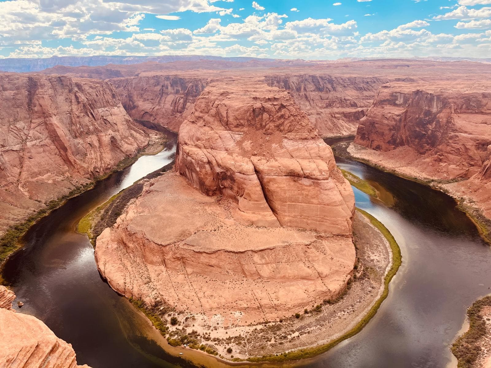
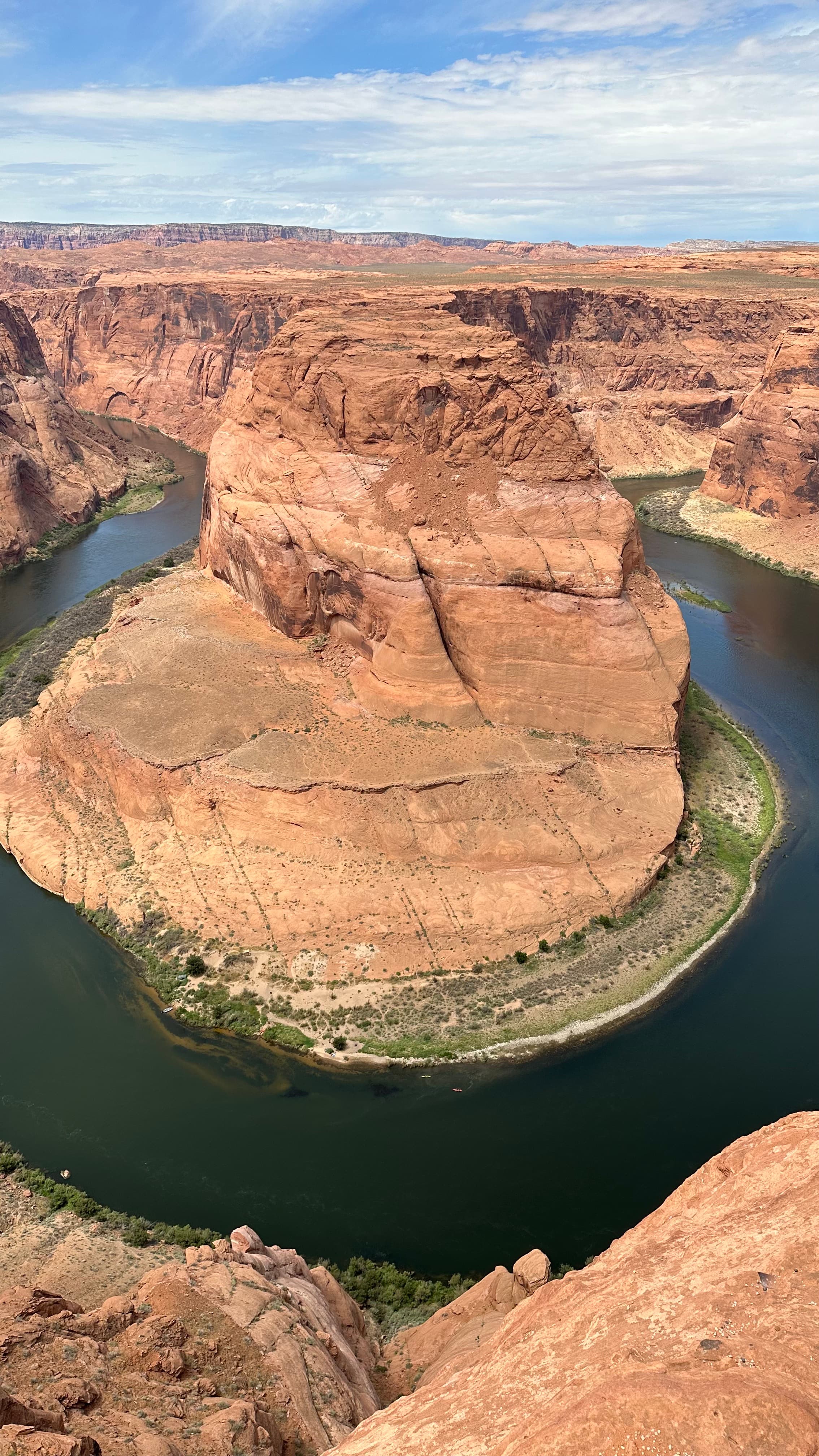
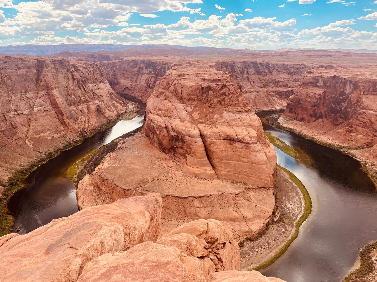
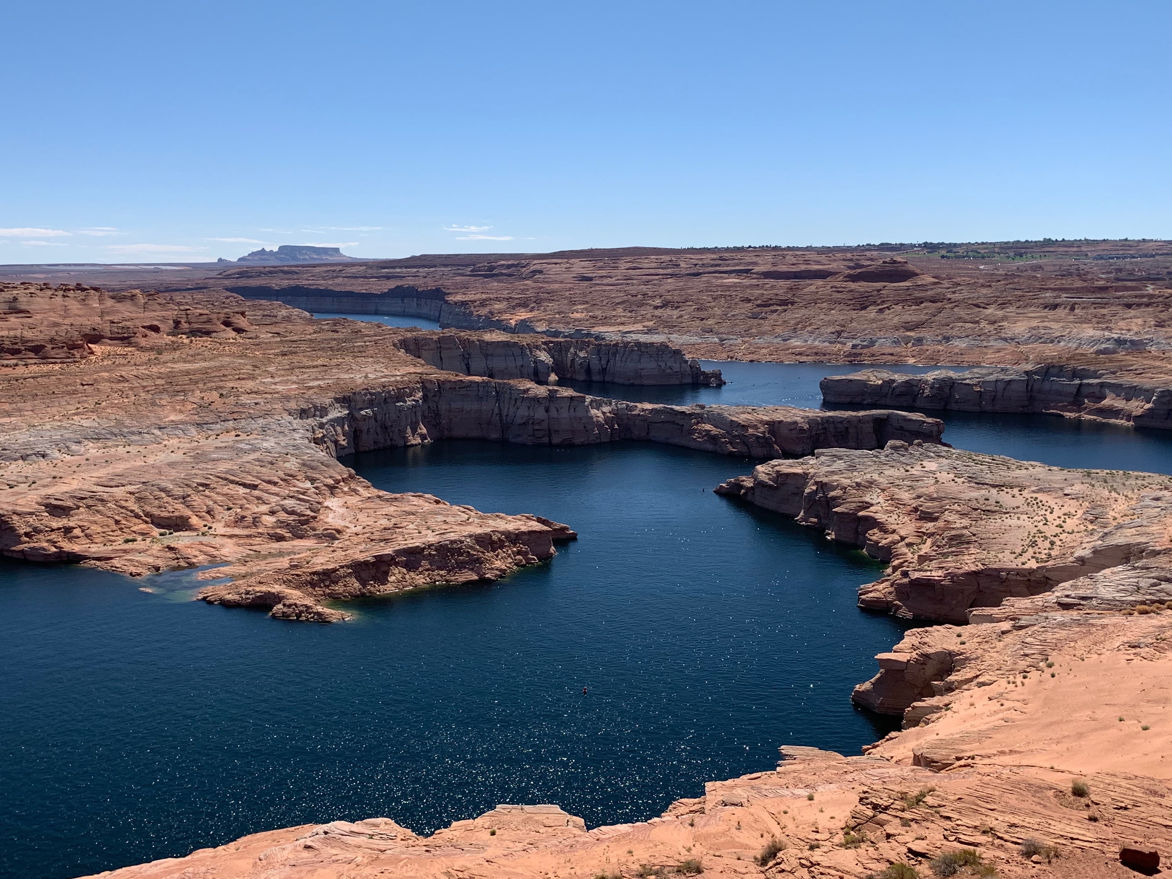
Horseshoe Bend is a 270-degree meander of the Colorado River carved 1,000 feet below the rim of a sandstone butte, six miles south of Page, Arizona. On my July 2025 visit I went back three times in 36 hours — dawn, midday and golden hour — specifically to test the conventional wisdom about when to go. This guide collects what I learned on the ground, cross-checked against current City of Page Parks & Recreation notices and the 2020 accessibility path additions: where to park, when the light actually works, what to expect from the walk, and how to pair the overlook with nearby Antelope Canyon without repeating the most common planning mistake.
Location
Page, AZ 86040
Parking
$10 per standard vehicle
Hike distance
0.7 mi each way · unshaded
Best time
4:30 – 6:00 pm (Apr – Oct)
Self-guided?
Yes — no tour needed
Accessibility
Partial path added 2020
What is Horseshoe Bend?
Horseshoe Bend is what geologists call an entrenched meander: the Colorado River, which once flowed across a flatter landscape, kept cutting down through the Navajo Sandstone as the Colorado Plateau rose around it. The result is a 270-degree loop around a steep-walled butte, with the river roughly 1,000 feet below the observation rim. The bend sits inside the boundary of Glen Canyon National Recreation Area, which the National Park Service administers, but the overlook itself — the parking lot, trail and viewing area — was transferred to the City of Page and is now run by Page Parks & Recreation.
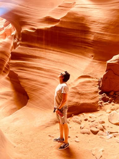
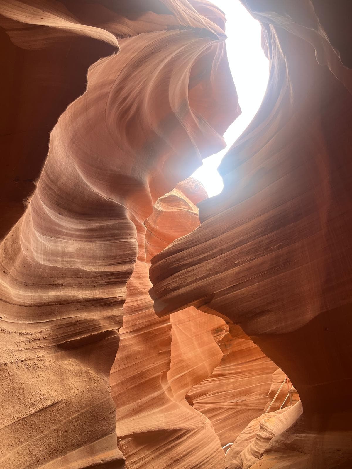
Instagram made Horseshoe Bend famous in the 2010s; before that, it was a quiet pullout on US-89 with a dirt lot. Visitation climbed from roughly 100,000 in 2010 to more than two million a year by 2019, which is why the paved lot, fee gate and trail upgrades exist at all. The name is literal — seen from above, the meander is the shape of a horseshoe around the butte. Its Navajo neighbour, Antelope Canyon, is on tribal land six miles east and requires a guided tour; Horseshoe Bend does not.
How do you get to Horseshoe Bend?
Horseshoe Bend is on US-89, 4.3 miles south of downtown Page and the Glen Canyon Dam bridge. The parking lot entrance is well signed on the west side of the highway. Typical drive times:
- From Page (town centre): 5–8 minutes. If you are already staying in Page, this is a 10-minute errand with a walk bolted on.
- From Las Vegas, NV: 4.5 hours (≈275 mi) via Hoover Dam, Kanab and US-89. This is the most common long drive — day-tripping from Vegas is doable but tight if you also want Antelope Canyon.
- From Phoenix, AZ: 4.5 hours (≈280 mi) via Flagstaff and US-89 north.
- From Grand Canyon South Rim: 2.5 hours (≈135 mi) via Cameron.
- From Zion National Park: 2 hours (≈115 mi) via Kanab.
The parking lot has roughly 300 standard spaces plus a separate RV / oversized section. A single attendant booth collects the $10 per-vehicle fee (card or cash, as of May 2026, per City of Page Parks & Recreation — full breakdown of fees, RV rates and ADA access). There is no visitor centre inside the lot — just restrooms, a small shade ramada and a water fountain (when operational; bring your own water). Plan as if you are arriving at a trailhead, not a park visitor centre: bring water, a hat and the navigation you need before you leave cell range.
If you are flying in, there is no realistic way to reach Horseshoe Bend without a car. Public transport to Page is limited to occasional long-distance shuttles, and rideshare availability at the overlook is effectively zero. For a road-trip rental, compare rates across aggregators:
Compare rental cars for the Page / Southwest road trip →
When is the best time to visit Horseshoe Bend?
For the full month-by-month breakdown including photography settings and how sunset compares to the afternoon-light window, see the dedicated best time to visit guide.
The single biggest mistake first-time visitors make is going at sunrise. It feels intuitive — cool temperature, fewer people, “golden hour” light — but the geometry of the bend works against you. In the morning the sun is behind you as you face the overlook, which lights the far cliff walls beautifully and drops the river into deep shadow. The classic photograph, with a visibly turquoise-green ribbon of water curving around a glowing butte, is a late-afternoon shot.
On my July 2025 test, the river was fully lit and readable from roughly 4:30 pm until the sun crossed the western cliff around 6:05 pm. Before that window the river was in partial shadow; after, the whole bend went flat. In winter the sweet spot shifts earlier — plan for roughly 3:00–4:30 pm in December and January.
Seasonal summary:
- March–May: Sweet spot. Mild temperatures (15–25°C), long days, manageable crowds outside spring break.
- June–August: Hot (35–40°C) and exposed. Monsoon thunderstorms build from early July; afternoon lightning is a real hazard on an unshaded rim.
- September–October: Second sweet spot. Monsoon tapers, crowds thin after Labor Day, light stays warm into early evening.
- November–February: Cold (overnight freezes), fewer visitors, shorter golden window. The sandstone takes on a muted rose colour that some photographers prefer.
Can you hike down to the river at Horseshoe Bend?
For the full trail breakdown (segment-by-segment), the 2020 ADA accessibility path, what to bring by season, and how to handle the hike with kids or older relatives, see the dedicated Horseshoe Bend hike guide.
Not from the overlook. The cliff face is effectively vertical for the first several hundred feet, and there is no sanctioned trail to the water from the rim. Every route that appears in old blog posts is either closed, on Navajo land, or dangerous.
The real way to reach the water inside the bend is by kayak or small raft from Lees Ferry, roughly 15 river miles downstream of Glen Canyon Dam. Licensed outfitters run half-day and full-day trips that include a motor shuttle upstream and a flat-water paddle back, with a beach stop inside the meander itself. Looking up at the rim from the water, after you've just looked down at the water from the rim, is the combination most people do not realise is possible in a single trip. Book a kayak experience separately if you want to add it to your itinerary — this guide focuses on the overlook.
Is Horseshoe Bend accessible?
Partially, and the situation has improved noticeably since the City of Page completed the accessibility upgrade in 2020. The main trail splits at a junction about halfway to the rim. The right branch is the original sandy path and ends at the unfenced main overlook. The left branch, added in 2020, is packed surface, wider, and ends at a raised fenced viewing platform — the only guardrailed spot on the rim.
Practical notes from my visit: a standard wheelchair can manage the left branch with one assistant pushing, especially on the return leg where the gentle hill becomes an uphill push. Power chairs handle it unassisted. Strollers roll along the packed surface but may need to be lifted over a short transition near the platform. The surface is still exposed sand in places and loose after winds — call ahead to Page Parks & Recreation if you need current conditions. There is still no accessible route to the unfenced main overlook itself.
How should you photograph Horseshoe Bend?
The bend is wider than most people expect — from a comfortable spot back from the edge you need a wide focal length to fit it into a single frame. On a full-frame camera, around 14–16mm works; on APS-C, about 10–12mm; on a phone, use the ultrawide (0.5×) lens. A standard phone wide angle will cut off either the inlet or the outlet of the meander.
Because the scene is extremely contrasty — bright sky, glowing cliff, dark river — shoot in HDR if your phone offers it, or bracket exposures on a dedicated camera. Tripods are allowed on the rim (unlike inside Antelope Canyon), but tripping hazards are everywhere; a handheld ultrawide exposure at 1/200s and ISO 200 is the reliable move. Drones are banned — both by FAA regulation (Glen Canyon NRA airspace) and by proximity to Navajo Nation land — and rangers actively enforce.
How does Horseshoe Bend compare to other Page viewpoints?
Horseshoe Bend is the most famous viewpoint in the area, but it is not the only one worth your time. If you have an extra half-day in Page — or if you are crowd-averse — the table below compares the four most visited rim viewpoints:
| Viewpoint | Best time | Cost | Effort | Crowds |
|---|---|---|---|---|
| Horseshoe Bend | 4:30 – 6:00 pm | $10 parking | 0.7 mi walk · easy | Heavy · always |
| Glen Canyon Dam overlook | Any time | Free | Short stair descent | Low |
| Alstrom Point | Sunset | Free (public land) | 4×4 required · 2 hr drive | Very low |
| Wahweap Overlook | Sunrise | NRA pass ($30/wk) | Drive-up | Low |
If you only have one viewpoint on the schedule, Horseshoe Bend remains the right choice — the 270-degree meander is genuinely unique, and the light window rewards the walk. If you have time for two, pair it with the Glen Canyon Dam overlook on the same afternoon; it is free, five minutes away and gives you a completely different perspective on the same river.
Can you combine Horseshoe Bend with Antelope Canyon?
Almost everyone does, and you should. The two sit six miles apart on opposite sides of Page, and a single well-planned day handles both comfortably — but the order of operations matters. The most common mistake is booking a mid-morning Antelope tour and then “grabbing” Horseshoe Bend afterwards at midday, when the river is washed out. The correct sequence is Antelope Canyon late morning (for the light beams in Upper, if that is on your list), lunch in Page, then Horseshoe Bend at 4:30–6:00 pm.
I've written the full one-day itinerary with exact tour start times, the driving loop and combo-tour picks:
→ Read: Antelope Canyon to Horseshoe Bend — the perfect one-day combo
Where should you stay near Horseshoe Bend?
The town of Page has the full accommodation base for the area: roughly 20 hotels and motels, several vacation rentals and a campground at Lake Powell. Staying in Page puts you within 10 minutes of both Horseshoe Bend and the Antelope Canyon tour meeting points. The next-closest realistic bases are Kanab, UT (1 hour west) and Marble Canyon (45 min south), both of which trade convenience for scenery.
For a short visit, I recommend staying one or two nights in Page proper, picking a property within walking distance of Lake Powell Boulevard (the main street) so you can eat without driving. Compare current rates:
Check hotel availability in Page, AZ →
Frequently asked questions
Is Horseshoe Bend free to visit?
The overlook itself is free, but the City of Page charges a $10 parking fee per standard vehicle (as of April 2026). There is no separate entry ticket and no National Park fee — Horseshoe Bend sits on city-managed land adjacent to Glen Canyon National Recreation Area.
How long does the Horseshoe Bend hike take?
The trail is 0.7 miles each way (1.4 miles round trip) on sandy, mostly flat ground with one gentle hill. Most visitors spend 30 to 45 minutes total including time at the overlook. Add 15 to 20 minutes if you want to find a quiet spot or shoot photos.
Can you see Horseshoe Bend without hiking?
No. There is no drive-up viewpoint. You must walk the 0.7-mile trail from the parking lot to the edge. The left branch of the trail has a partial accessibility path added in 2020, but wheeled access still requires the full walk.
What time of day is best for Horseshoe Bend photos?
Roughly 4:30–6:00 pm from April through October, and 3:00–4:30 pm in winter. Late-afternoon light raises the Colorado River out of the shadow of the butte and adds warm tones to the sandstone. Morning is the most common visitor mistake: the sun lights the cliff walls but the river goes dark.
Is Horseshoe Bend safe for kids?
The main overlook has no guardrail — only a 1,000-foot vertical drop to the Colorado River. A single fenced platform exists on the left (accessibility) branch of the trail. If you visit with children, use the fenced platform and supervise closely at all other points along the rim.
Can you swim in the Colorado River at Horseshoe Bend?
Not from the overlook — the cliffs are sheer. It is possible to reach the water inside the bend by kayak from Lees Ferry, roughly 15 river miles downstream of Glen Canyon Dam. Several licensed outfitters run half-day and full-day kayak trips that beach inside the meander.
Can you just drive to Horseshoe Bend?
You can drive to the parking lot at Horseshoe Bend — it is directly off US-89, 4.3 miles south of Page, AZ, and takes 5–8 minutes from town. Park for $10 per vehicle. However, you cannot drive to the overlook itself: there is no drive-up viewpoint. From the parking lot, you walk a 0.7-mile unpaved trail (mostly flat, one gentle hill) to the rim — roughly 15–20 minutes each way. There is no workaround for the walk. The left branch of the trail (added in 2020) has a packed-surface accessible path ending at a fenced platform, suitable for wheelchairs with assistance.
About this guide
Written by Diego Fresno, travel writer and independent publisher specialising in the American Southwest. Based on visits to Horseshoe Bend at different times of day (dawn, midday, golden hour) in July 2025 to test the light mechanism, and cross-referenced with the City of Page's 2020 accessibility path additions. Verified quarterly — last review April 2026. About the author →
Related guides
The Horseshoe Bend hike (2026)
0.7-mile trail breakdown, the 2020 ADA path, what to bring by season and how to handle heat, monsoon and winter.
Best time to visit Horseshoe Bend
Why sunrise does not work, the afternoon-light window month by month, and photography settings for the rim.
Horseshoe Bend parking guide
$10 fee, ~300 spaces, RV rates, ADA path and the best time of day to find a space without queueing.
Camping near Horseshoe Bend (2026)
5 options from free dispersed camping at Lone Rock Beach to full-hookup RV resorts 5 minutes from the viewpoint.
Antelope Canyon to Horseshoe Bend: the perfect one-day combo
Exact driving route, tour start times and how to avoid the midday-light mistake.
Antelope Canyon: Upper, Lower & Canyon X
The three main sections compared, Navajo operators ranked and current photography rules.
Page, Arizona: how to use it as a basecamp
Where to stay, what to eat and how many days you actually need in town.