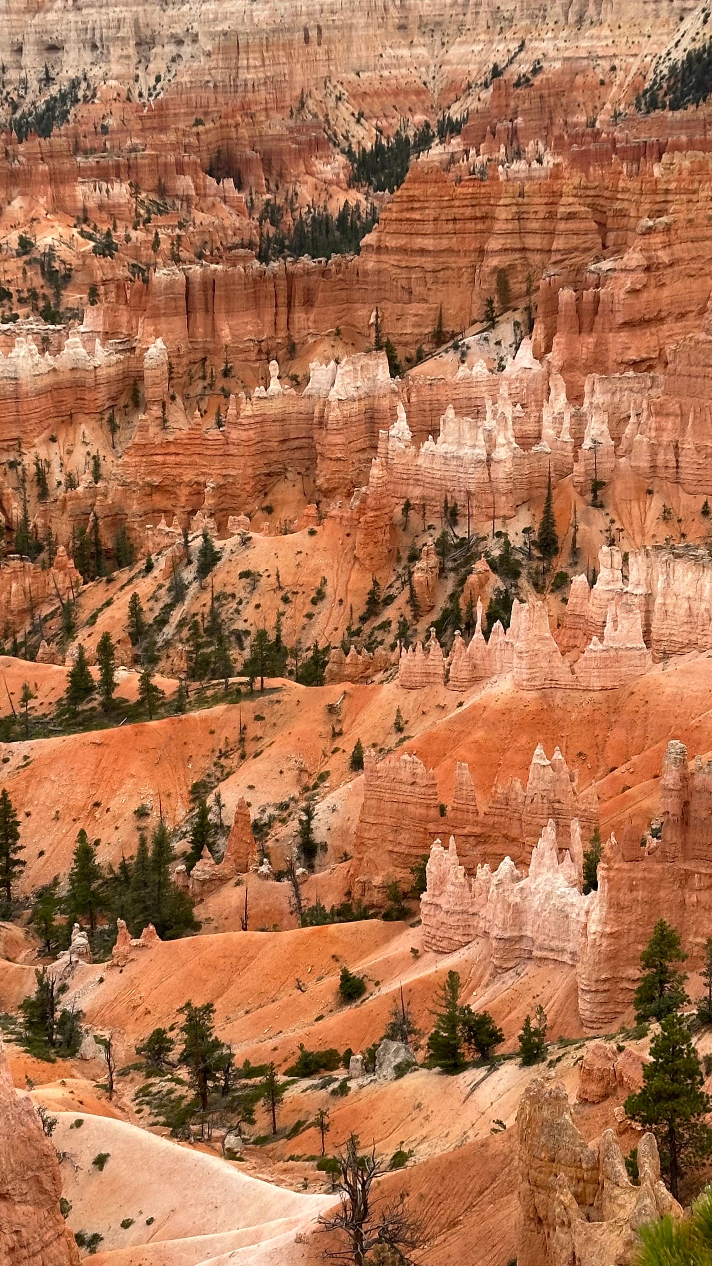
Bryce Canyon National Park contains the highest concentration of hoodoos on Earth: thousands of orange, red, and white limestone spires packed into a series of natural amphitheaters carved into the edge of the Paunsaugunt Plateau. Despite the name, Bryce Canyon is not technically a canyon. It is a collection of bowl-shaped basins where water, ice, and wind have sculpted the plateau into its famous landscape over millions of years. The park sits at 8,000 to 9,100 feet elevation in southern Utah, 261 miles from Las Vegas and 86 miles from Zion National Park. This guide covers everything you need to know to plan a visit.
Location
Garfield County, Utah (entirely in UT, not Arizona)
Elevation
8,000 to 9,100 ft (cooler than Las Vegas by 20-30°F)
Entry fee
$35/vehicle · $20/person on foot or bike · 7-day pass
Park shuttle
Free, runs May through September
Permits required
No permits needed for any main trail
Best hike
Queen's Garden + Navajo Loop (2.9 mi, 521 ft)
Best viewpoint
Inspiration Point (widest panoramic view)
Stargazing
Certified International Dark Sky Park · 7,500 stars visible
Distance from Las Vegas
261 miles · ~4 hours via I-15 North
Distance from Zion NP
86 miles · ~1.5 hours
Annual visitors
~2.5 million
What is Bryce Canyon?
Bryce Canyon was established as a National Monument in 1923 and became a National Park in 1928. The landscape is defined by hoodoos, tall, thin rock spires formed by a specific combination of geology and climate:
- The rock: The Claron Formation limestone that makes up the plateau is soft enough to erode quickly but hard enough to hold vertical shapes for thousands of years.
- The mechanism: Frost wedging. Bryce Canyon sits at an elevation where temperatures cross the freezing point over 200 times per year. Water seeps into cracks, freezes overnight (expanding by 9%), and forces the rock apart. This repeated cycle gradually carves the plateau into spires.
- The result: Thousands of hoodoos ranging from a few feet to 200 feet tall, in shades of orange, red, purple, and white depending on mineral content. No two are the same shape.
The amphitheaters (Bryce Amphitheater being the largest and most visited) are accessible from both the rim above and the trails that descend among the formations. This is the key difference from the Grand Canyon: at Bryce, the most rewarding experience is not looking down from the rim but descending into the hoodoo field on foot.
Is Bryce Canyon worth visiting?
Yes, unambiguously. Bryce Canyon consistently ranks among the most visually distinctive national parks in the US, and for good reason: there is no landscape on Earth that looks quite like it. The hoodoo amphitheater is one of those places where photographs, even good ones, fail to convey the scale and density of what you are standing in front of.
For a Southwest road trip, Bryce Canyon pairs naturally with Zion (86 miles away) and is accessible from Las Vegas as a day trip, though an overnight stay makes the experience significantly better. The park is smaller and less overwhelming than the Grand Canyon, which makes it a strong choice for visitors who want a manageable, high-impact experience.
The main limitation is altitude. At 8,000 to 9,100 feet, some visitors experience mild altitude effects (headache, fatigue, shortness of breath), especially arriving directly from Las Vegas (2,000 ft). This is worth knowing before you book a 5-hour hike as your first activity.
Getting there
Bryce Canyon has no commercial airport. The nearest airports are Salt Lake City (257 miles), Las Vegas (261 miles), and St. George Regional Airport (100 miles). A rental car is the standard way to visit: there is no meaningful public transport to the park.
| From | Distance | Drive time | Main route |
|---|---|---|---|
| Las Vegas, NV | 261 miles | ~4 hours | I-15 N → US-89 N → UT-12 → UT-63 |
| Salt Lake City, UT | 257 miles | ~3.5 hours | I-15 S → US-89 S → UT-12 → UT-63 |
| Zion National Park | 86 miles | ~1.5 hours | UT-9 E → US-89 N → UT-12 → UT-63 |
| St. George, UT | 105 miles | ~1.75 hours | I-15 N → US-89 N → UT-12 → UT-63 |
| Phoenix, AZ | 450 miles | ~6.5 hours | I-17 N → US-89 N → UT-12 → UT-63 |
The final approach on UT-12 and UT-63 climbs onto the plateau and is one of the most scenic drives in Utah. Standard rental cars handle the road without difficulty. There are no dangerous sections or narrow mountain passes.
Driving from Las Vegas? See the full step-by-step route, day-trip itinerary, and Zion combo schedule in our dedicated guide:
Entrance fees and park hours (2026)
The entrance fee covers 7 consecutive days of access. You can enter and exit the park as many times as you like during that period.
| Pass type | Cost | Best for |
|---|---|---|
| Vehicle (up to 15 passengers) | $35 | Most visitors arriving by car |
| Motorcycle | $20 | Motorcycle riders |
| Individual (on foot, bike) | $20 | Hikers and cyclists arriving without a vehicle |
| America the Beautiful Annual Pass | $80/year | Visiting 2+ national parks in a year |
The America the Beautiful Annual Pass covers Bryce Canyon plus all other National Park Service sites, US Forest Service areas, Bureau of Land Management recreation sites, and more. At $80 per year, it pays for itself after 2 to 3 park visits. You can purchase it at the entrance station or in advance online.
Park hours: Bryce Canyon is open 24 hours, 365 days a year. The entrance fee station operates during daylight hours (approximately 7am to 8pm in summer, shorter in winter). Arriving outside staffed hours is possible using the self-pay envelope system. The visitor center is open 8am to 8pm in peak season (May to October), with reduced hours November to April.
Free shuttle: From May through September, a free park shuttle runs between the visitor center and all major viewpoints on a 10 to 15 minute frequency. Using the shuttle means you park once at the visitor center and do not need to move your car for each stop.
The best viewpoints
All major viewpoints are accessible by car or by the free park shuttle, and connected by the rim trail (5.5 miles total). Listed from north to south:
- Sunrise Point: First stop after the visitor center. Wide view of the northern amphitheater including the Queen Victoria hoodoo. Best light is mid-morning rather than sunrise (the rim blocks early direct light).
- Sunset Point: The most visited viewpoint, and the access point for the Navajo Loop trail. Thor's Hammer (Bryce's most photographed hoodoo) is visible from here. Gets crowded by 9am in summer.
- Inspiration Point: The single best panoramic viewpoint in the park. A short uphill walk from the road. The view spans the full Bryce Amphitheater from end to end. Prioritize this if you only have one hour.
- Bryce Point: Farthest south among the main viewpoints (6 miles from the entrance). Fewer crowds. Looking north from here gives you the full amphitheater with the most dramatic foreground. Best at sunset when western light hits the hoodoos directly.
- Natural Bridge: 11 miles from the entrance. A large natural sandstone arch framing a view of the canyon below. Less visited and worth the extra drive.
- Rainbow Point: The southernmost viewpoint (18 miles from the entrance) at 9,100 feet, the highest point in the park. On clear days, you can see parts of four states.
Best hikes
Unlike Zion, where top hikes require permit lotteries and shuttle logistics, all of Bryce Canyon's main trails are open to anyone with a valid park entry. No permits required.
| Trail | Distance | Elevation | Difficulty | Best for |
|---|---|---|---|---|
| Queen's Garden + Navajo Loop | 2.9 miles | 521 ft | Moderate | Day trippers, first visit: the essential Bryce hike |
| Rim Trail (full) | 5.5 miles | Mostly flat | Easy | Families, accessibility, overview of all viewpoints |
| Fairyland Loop | 8 miles | 1,980 ft | Strenuous | Experienced hikers wanting solitude |
| Tower Bridge | 3 miles | 800 ft | Moderate | Natural arch, less visited alternative |
| Bristlecone Loop | 1 mile | 100 ft | Easy | Ancient bristlecone pines at Rainbow Point |
The recommended hike: Queen's Garden and Navajo Loop
Start at Sunrise Point, descend into the amphitheater through Queen's Garden (named for a hoodoo resembling Queen Victoria), cross the canyon floor, then climb back up through Wall Street, a narrow slot canyon section with walls only a few feet apart. Exit at Sunset Point (0.5 miles from Sunrise Point along the rim trail). The complete loop takes 2 to 3 hours at a comfortable pace.
The descent is moderate. The ascent through Wall Street is steeper. Not recommended for anyone with serious knee issues. In winter and early spring, microspikes are advisable on the descending sections.
Where to stay near Bryce Canyon
Accommodation options range from inside the park to the small cluster of hotels in Bryce Canyon City, 2 miles from the entrance.
- The Lodge at Bryce Canyon (inside the park): The only in-park lodging. Historic cabins and hotel rooms at 7,900 feet. A unique experience: you can walk to the rim at sunrise without driving. Books up months in advance for summer; reserve as early as possible on recreation.gov.
- Ruby's Inn / Best Western Plus Bryce Canyon Grand Hotel: The largest hotel complex near the park (2 miles from the entrance). Full amenities including restaurants, coin laundry, fuel, and a general store. Prices range from $180 to $350/night in summer.
- Bryce View Lodge: Across the road from Ruby's Inn, slightly more affordable. Basic rooms, same convenient location. Around $130 to $220/night.
- Bryce Canyon Pines Motel: 6 miles from the entrance. Budget option with a small restaurant. From $120/night.
- Springdale (near Zion, 86 miles away): If combining Zion and Bryce Canyon in a 2-day trip, staying in Springdale gives better access to Zion on day one and an early start for Bryce on day two.
Camping is available at North Campground and Sunset Campground (both inside the park, bookable on recreation.gov) and several dispersed camping areas on surrounding National Forest land.
Hotels Near Bryce Canyon: Complete 2026 Guide
The Lodge at Bryce Canyon, Best Western Plus properties, Stone Canyon Inn, and budget options in Panguitch and Kanab. Full pros and cons for every option.
Read more →Best Bryce Canyon Tours 2026: Scenic, Horseback and Stargazing
Top-rated guided tours inside the park, Ruby's horseback rides, stargazing adventures, and slot canyon day trips from the Bryce area.
Read more →Best time to visit Bryce Canyon
Because of its elevation (8,000+ ft), the seasonal experience at Bryce Canyon is very different from other Southwest parks.
| Season | Temps (rim) | Crowds | Trail conditions |
|---|---|---|---|
| Spring (Apr–Jun) | 40–70°F | Building to peak by Memorial Day | Snow gone from main trails by mid-April; Wall Street may be icy into May |
| Summer (Jul–Aug) | 60–80°F | Peak season | All trails open; afternoon thunderstorms 3–5pm; arrive early |
| Fall (Sep–Oct) | 35–65°F | Drops sharply after Labor Day | Best conditions: clear air, fall colors, fewer people |
| Winter (Nov–Mar) | 10–40°F | Minimal | Snow on hoodoos (spectacular); some trails need microspikes; shuttle does not run |
The sweet spot: September and early October. Crowds thin after Labor Day, temperatures are comfortable for hiking, the air is clear, and you may see aspens and cottonwoods turning gold along the canyon floor. The shuttle still runs through September.
For Las Vegas day-trippers: May through June and September give the best balance of comfortable temperatures, open trails, and manageable crowds. Summer works if you leave Las Vegas by 6am; you arrive before the heat builds and before afternoon thunderstorm risk increases.
Stargazing: a certified Dark Sky Park
Bryce Canyon is an International Dark Sky Park, recognized by the International Dark-Sky Association for its exceptional night sky quality. On a clear night, you can see approximately 7,500 stars with the naked eye, compared to fewer than 200 in most cities and around 2,500 in rural areas. The Milky Way is clearly visible from May through October.
Factors that make Bryce Canyon exceptional for stargazing:
- Elevation: 8,000+ feet reduces atmospheric interference, resulting in sharper, brighter stars.
- Low humidity: The high desert air has minimal moisture, which reduces light scattering.
- Distance from cities: The nearest large city (Cedar City, UT) is over 50 miles away. Las Vegas, the nearest major light polluter, is 261 miles.
The park hosts an Astronomy Festival each June with telescope viewing, ranger presentations, and guided night sky programs. Outside the festival, ranger-led stargazing programs run on select summer evenings from the Sunset Point area; check the NPS schedule when you arrive.
The best stargazing viewpoints are Inspiration Point and Bryce Point, both of which face away from the park entrance and have minimal artificial light. New moon phases produce the darkest skies.
Guided tours
Most visitors drive to Bryce Canyon independently. Guided day tours from Las Vegas and Salt Lake City are available if you prefer not to drive.
Small Group Bryce Canyon and Zion Tour from Las Vegas
Zion and Bryce Canyon in one 14-hour day from Las Vegas. Hotel pickup included, morning at Zion Canyon, afternoon among Bryce hoodoos. Free cancellation.
Practical tips
- Altitude acclimatization: If driving directly from Las Vegas (2,000 ft) to Bryce Canyon (8,000+ ft), allow an hour or two before starting strenuous hikes. Drink more water than you think you need. Headache and unusual tiredness are common on the first day at altitude.
- Water: Potable water is available at the visitor center and at North and Sunset Campgrounds. Carry at least 2 liters per person on any hike. The dry air and elevation mean dehydration happens faster than at sea level.
- Layers: Rim temperatures are 20 to 30°F cooler than Las Vegas. A light jacket is useful even in summer, especially in the morning and evening.
- Sunscreen: At 8,000 feet, UV exposure is significantly higher than at sea level. Apply even on overcast days.
- No pets on trails: Pets are not allowed on any backcountry or main hiking trails in Bryce Canyon. They can accompany you on the rim trail and in the campgrounds on a leash.
- Cell coverage: Limited inside the park. Download the NPS Bryce Canyon app and offline maps before entering.
- Fuel: The last reliable fuel stop before the park is Ruby's Inn (2 miles from the entrance) or Panguitch (25 miles west on US-89). Do not arrive on empty.
Frequently asked questions
What is Bryce Canyon National Park known for?
Bryce Canyon is known for its vast natural amphitheater filled with thousands of hoodoos, the tall, thin limestone spires that give the park its distinctive look. It has the highest concentration of hoodoos on Earth. The park also has some of the darkest skies in the continental US and is certified as an International Dark Sky Park, making it one of the best places in North America for stargazing.
How much does it cost to enter Bryce Canyon?
The entrance fee is $35 per vehicle (valid for 7 days), $20 per motorcycle, or $20 per person on foot or bicycle. The America the Beautiful Annual Pass (National Parks Pass, $80/year) covers Bryce Canyon and all other US National Parks and federal recreation areas; it pays for itself after 2-3 park visits.
What is the best hike in Bryce Canyon?
The Queen's Garden and Navajo Loop combo is the single best hike in the park for most visitors: 2.9 miles total, 521 feet of elevation change, and it takes you down among the hoodoos rather than just viewing them from the rim. The Wall Street section passes through a narrow canyon with walls only a few feet apart. The Fairyland Loop (8 miles) is the best option for experienced hikers wanting fewer crowds.
Is Bryce Canyon in Arizona or Utah?
Bryce Canyon National Park is entirely in Utah, in Garfield County. Despite the name, it is not actually a canyon: it is a series of bowl-shaped amphitheaters carved into the eastern edge of the Paunsaugunt Plateau. The park sits at 8,000 to 9,100 feet elevation, significantly higher and cooler than neighboring Arizona.
Do you need a permit to hike Bryce Canyon?
No. Unlike Zion's Angels Landing or The Wave at Vermilion Cliffs, none of the main Bryce Canyon hikes require a permit. The Queen's Garden, Navajo Loop, Rim Trail, and Fairyland Loop are all open to anyone who has paid the park entry fee. In summer (May through September), a free park shuttle runs between viewpoints and trailheads so you only need to park once at the visitor center.
What time does Bryce Canyon open?
Bryce Canyon National Park is technically open 24 hours a day, 365 days a year. The entrance fee station is staffed during daylight hours (typically 8am to 8pm in summer, shorter hours in winter). Arriving before or after staffed hours is possible; self-pay envelopes are available. The visitor center is open 8am to 8pm in peak summer, shorter hours in shoulder and winter seasons.
How far is Bryce Canyon from Zion National Park?
Zion and Bryce Canyon are 86 miles apart by road (about 1.5 hours via US-89 North and UT-12). This makes them the most natural pairing for a Southwest road trip: most visitors combine both parks in a 2- or 3-day itinerary. Zion is closer to Las Vegas (165 miles, 2.5 hours); Bryce Canyon is farther (261 miles, 4 hours) but less crowded and often considered the more unique experience.
Can you see stars at Bryce Canyon?
Yes. Bryce Canyon is one of the best places in the continental US for stargazing. The park is a certified International Dark Sky Park and on a clear night you can see 7,500 stars with the naked eye, compared to fewer than 200 in most cities. The park's high elevation (8,000+ ft) and distance from major cities minimize light pollution. The park hosts an annual Astronomy Festival each June. Rangers give stargazing programs through the summer.
Written by Diego Fresno, travel writer covering the American Southwest. Bryce Canyon information verified against NPS.gov, park shuttle schedules, trail conditions reports, and IDA dark sky certification records, August 2026.. Verified quarterly: last review April 2026. About the author →
Related guides
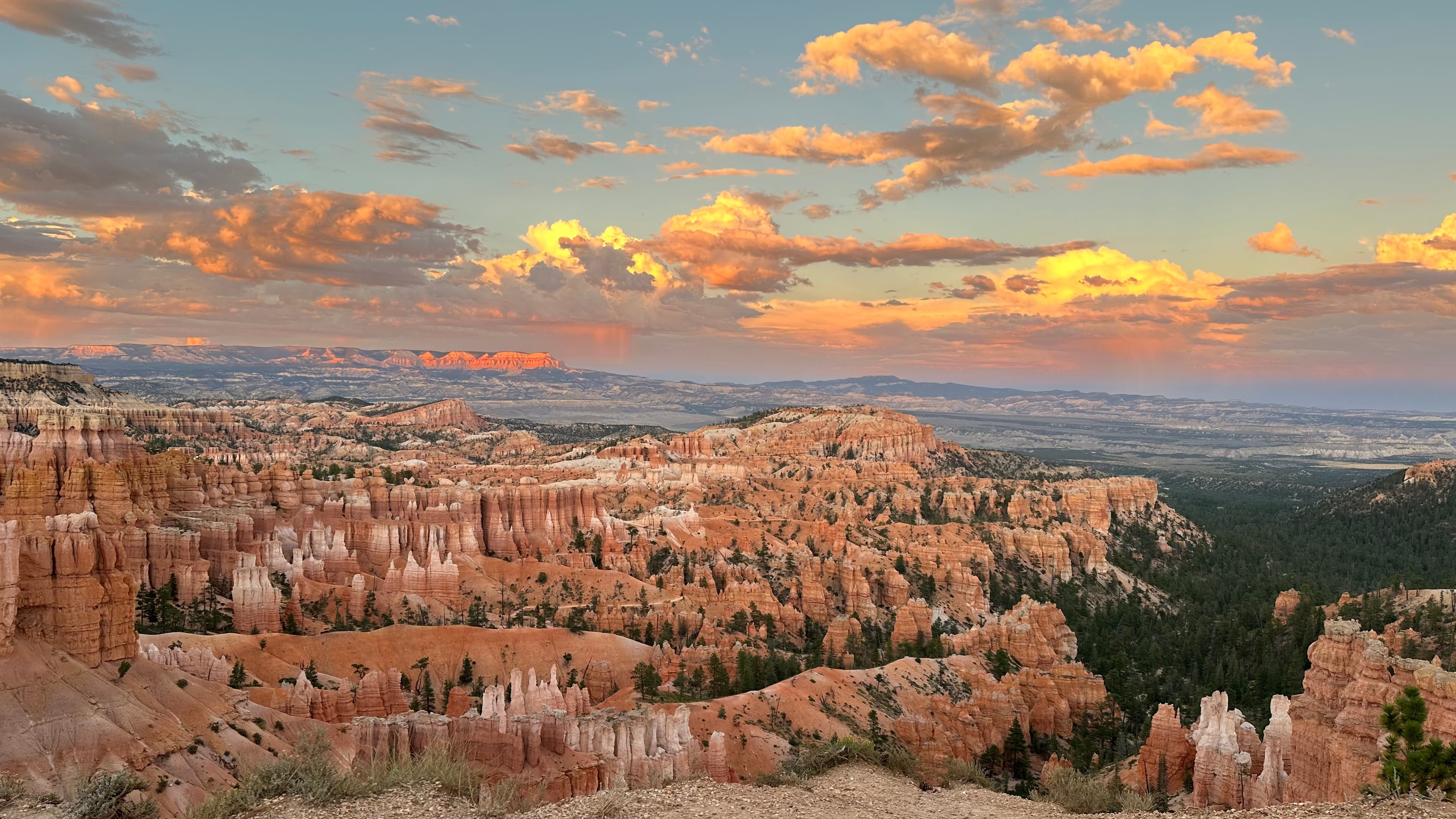
Las Vegas to Bryce Canyon: drive, hikes and day trip guide
261 miles, step-by-step route, day-trip vs overnight comparison, and how to combine Bryce with Zion in 2 days.
Read more →Las Vegas to Zion National Park: the complete guide
165 miles, 2.5 hours via I-15 North. Angels Landing permit, The Narrows, shuttle logistics, and combining with Bryce Canyon.
Read more →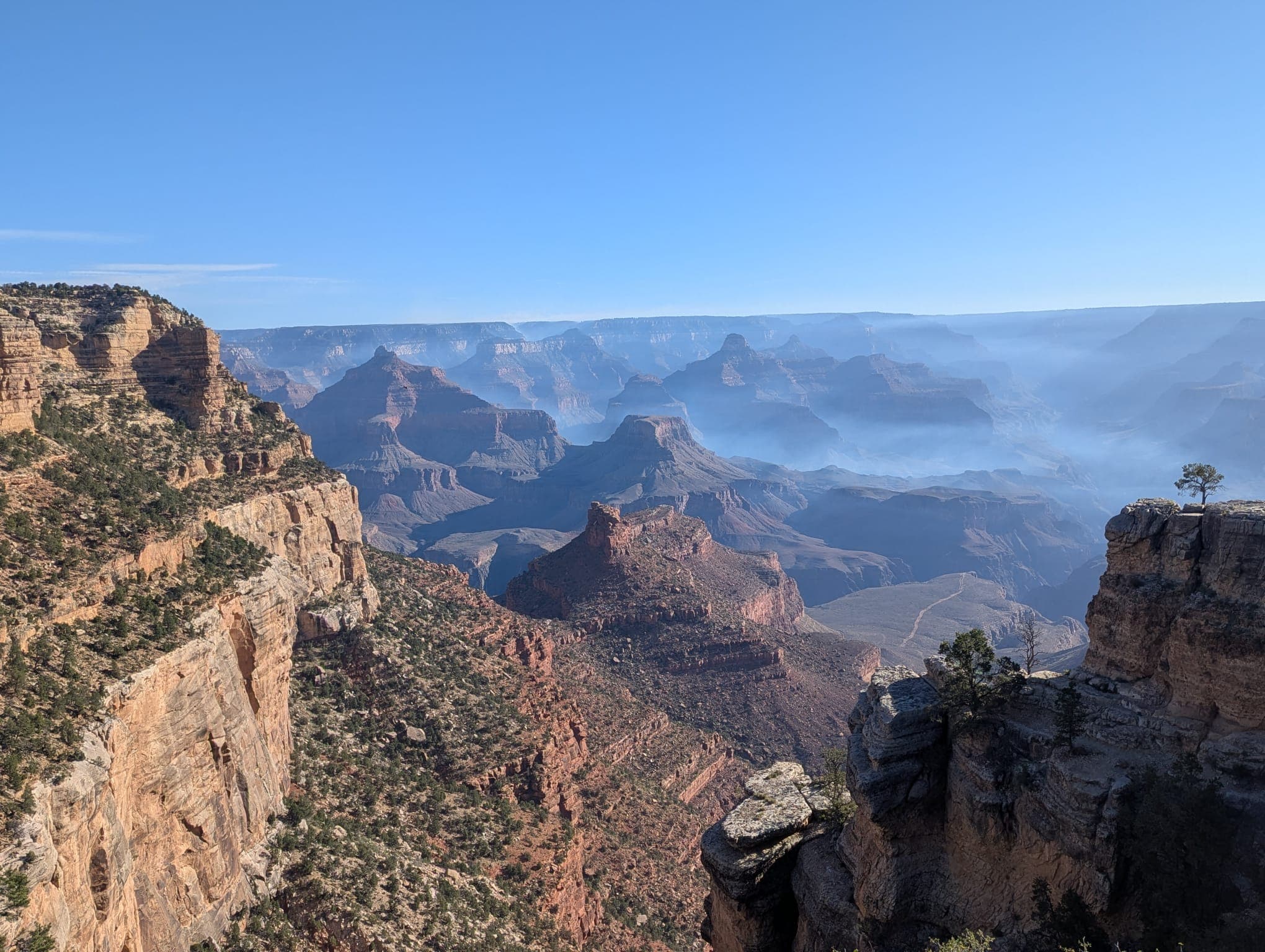
Grand Canyon from Las Vegas: every option compared
West Rim, South Rim, North Rim: which one to visit, how to get there, and what each rim actually looks like.
Read more →