Bryce Canyon has fewer miles of trail than most national parks, but the density of scenery per mile is unmatched. The main amphitheater concentrates the best hoodoo formations within a handful of interconnected trails, which means the decision is less about which trail and more about how much time and energy you want to spend. This guide gives you the honest breakdown: distances, elevation gains, what each trail actually feels like, and the one combination that makes everything else optional.
One thing every trail guide undersells: the altitude. The main trailheads sit at 8,000 to 8,100 feet (2,400 m). Visitors arriving from Las Vegas, Phoenix, or any sea-level city will notice the thin air on the first climb. Budget more time than the distances suggest and drink water before you start.
Park entry fee
$35/vehicle (valid 7 days)
Main trailhead elevation
8,000-8,100 ft (2,440 m)
Rainbow Point elevation
9,115 ft (2,778 m)
Trail season
All year (winter conditions Nov-Mar)
Dogs allowed
Rim Trail only (not below the rim)
Park shuttle
Free, connects main trailheads
All Bryce Canyon trails at a glance
| Trail | Distance | Elev. gain | Difficulty | Time |
|---|---|---|---|---|
| Navajo + Queen's Garden | 2.9 mi (4.7 km) | 521 ft (159 m) | Moderate | 2-3 h |
| Navajo Loop | 1.3 mi (2.1 km) | 521 ft (159 m) | Moderate | 1-2 h |
| Queen's Garden | 1.8 mi (2.9 km) | 319 ft (97 m) | Easy-Moderate | 1.5-2 h |
| Rim Trail (full) | 11 mi (17.7 km) | 1,754 ft (535 m) | Easy-Moderate | Full day |
| Rim Trail (paved section) | 1 mi (1.6 km) | 34 ft (10 m) | Easy | 30-45 min |
| Fairyland Loop | 8 mi (12.9 km) | 1,521 ft (464 m) | Moderate-Strenuous | 4-5 h |
| Peekaboo Loop | 5.5 mi (8.9 km) | 1,600 ft (488 m) | Strenuous | 3-4 h |
| Bristlecone Loop | 1 mi (1.6 km) | 200 ft (61 m) | Easy | 45-60 min |
| Mossy Cave Trail | 0.8 mi (1.3 km) | 100 ft (30 m) | Easy | 30-45 min |
Navajo Loop + Queen's Garden: the trail to do first
If you only hike one thing at Bryce Canyon, this is it. The loop descends from Sunset Point via the Navajo Loop (including Wall Street), crosses the amphitheater floor past Thor's Hammer and through the hoodoo forest, then climbs out at Sunrise Point through Queen's Garden. Total: 2.9 miles, 521 feet of elevation gain, 2-3 hours for most visitors.
The reason this combination works better than either trail alone: you see three completely different environments. Wall Street puts you between canyon walls so narrow the sky narrows to a strip. The amphitheater floor has the famous red, orange, and white hoodoos at eye level. Queen's Garden winds through formations that look sculpted, earning their name from the vaguely human shapes at the top. Doing just one trail means seeing only one of these.
Trailhead: Sunset Point (from Bryce Canyon Visitor Center, head south 1 mile). The free park shuttle connects Sunrise Point (exit) back to Sunset Point (start) every few minutes in peak season, so you do not backtrack.
Bryce Canyon Guided Hike: Conquer the Hoodoos
A 2.5-hour certified guided hike of the Navajo Loop and Queen's Garden trail. The guide covers hoodoo geology, how the amphitheater formed, and the erosion rates that are actively changing the landscape. Starts at Sunset Point. Shuttle to trailhead included. Suitable for ages 8 and up; approximately 3 miles of moderate terrain.
Navajo Loop Trail (Wall Street)
1.3 miles round trip · 521 ft elevation gain · Moderate · 1-2 hours
The Navajo Loop is the most dramatic single trail in the park. It descends 600 feet from Sunset Point via two very different routes: the Thor's Hammer switchbacks on one side, and Wall Street on the other. Wall Street is the one to take on the descent: a narrow slot canyon where 100-foot walls of orange and red rock rise on both sides and two ancient Douglas fir trees grow from the canyon floor.
The trail is short but steep. The ascent on the return is the harder half, happening at 8,000 feet. Take your time on the climb; it is not the distance but the elevation that slows most hikers. Trail surface is packed dirt and rock, with stairs cut into sections of the switchbacks.
Note: Wall Street closes periodically due to rockfall risk. Check the NPS website or the Visitor Center board on the day of your visit. When it is closed, the alternate switchback route on the opposite side remains open.
Queen's Garden Trail
1.8 miles round trip · 319 ft elevation gain · Easy-Moderate · 1.5-2 hours
Queen's Garden is the easiest trail that actually takes you below the rim and into the hoodoos. The descent is gentler than the Navajo Loop, making it the better choice for families with young children or visitors who want to walk the canyon floor without committing to steeper terrain.
Trailhead at Sunrise Point. The trail winds down through formations named for their resemblance to figures: the "Queen Victoria" hoodoo at the far end of the loop is the one everyone stops to photograph. The trail bottom has a small flat area with benches.
As a standalone out-and-back, this trail covers the Queen's Garden section only. Most visitors find it leaves them wanting more, which is why the Navajo + Queen's Garden combo makes more sense if you have the energy.
Fairyland Loop (full-day hike)
8 miles · 1,521 ft elevation gain · Moderate-Strenuous · 4-5 hours
Fairyland is the least-crowded major trail in the park and the one serious hikers come back for. It starts at Fairyland Point, a separate parking area 1 mile before the main Visitor Center entrance, so many visitors drive past it without noticing.
The trail passes Tower Bridge (a natural arch with two hoodoo pillars), descends into Campbell Canyon, and loops back along the rim with views of the Sinking Ship mesa and Boat Mesa formations. The 8-mile distance and 1,521 feet of elevation gain require a full morning or afternoon; start early and bring at least 2 liters of water per person. No shade for long stretches in summer.
Best months: May-June and September-October. In summer, start before 8 am to avoid the afternoon heat and any risk of thunderstorms.
Rim Trail (any fitness level)
Full trail: 11 miles · Moderate. Paved section: 1 mile · Easy
The Rim Trail runs along the canyon edge between Fairyland Point and Bryce Point, passing every major viewpoint in the park. Most visitors walk sections of it between viewpoints rather than the full 11 miles. The paved section between Sunrise Point and Sunset Point (1 mile, 34 feet of elevation change) is suitable for all ages and is the only park trail that allows dogs.
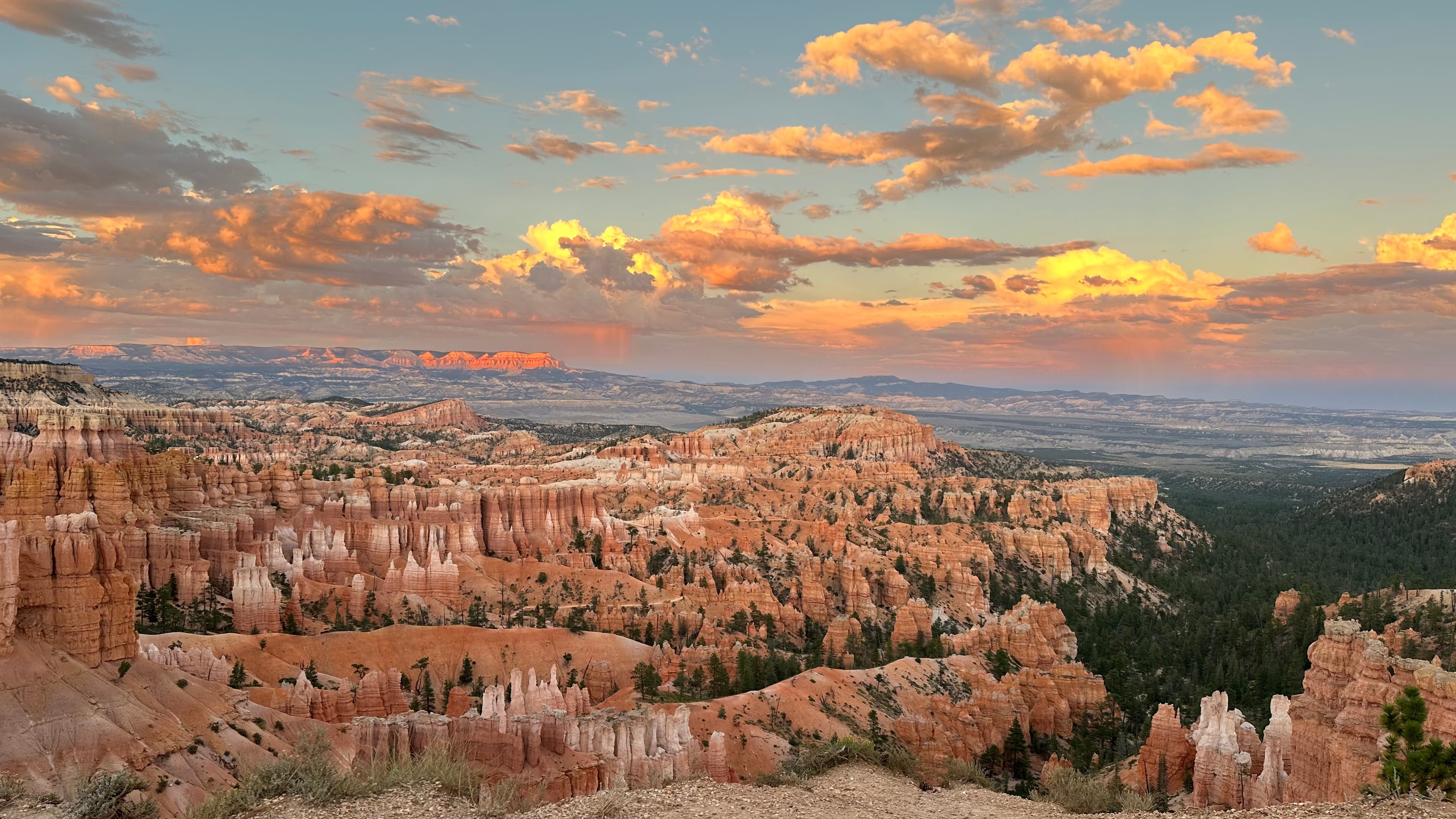
The Rim Trail is at its most dramatic at sunrise and sunset, when low-angle light turns the hoodoos orange and red. Inspiration Point, about 0.6 miles south of Sunset Point along the rim, is one of the best photography spots in the park and easily reached from the main parking area.
The free park shuttle stops at every major rim viewpoint, so you can walk one direction and shuttle back, or hop on and off between sections.
Peekaboo Loop (most strenuous)
5.5 miles · 1,600 ft elevation gain · Strenuous · 3-4 hours
Peekaboo Loop descends from Bryce Point (the southernmost parking area in the main amphitheater section) and winds through the deepest part of the amphitheater, with views of the Wall of Windows and other formations not visible from the rim. The trail is the only one in the park shared with horses from Ruby's Horseback Adventures; yield to horses and step off the trail downhill to let them pass.
The 1,600 feet of cumulative elevation gain is spread over the full loop with no single brutal section, but the combination of distance and altitude makes this a genuine workout. Fit hikers who want the most remote-feeling experience in the main amphitheater without entering the backcountry will find it here.
Peekaboo connects to both the Navajo Loop and Queen's Garden, so experienced hikers sometimes combine all three as a 7-9 mile loop. A very full day.
Prefer to cover the same terrain without the effort? Ruby's Horseback Adventures runs guided rides into the canyon on the same trails that share the Peekaboo route. It is the only horseback operator in the Bryce Canyon area.
Ruby's Horseback Adventures: 1.5-Hour Ride
A 1.5-hour guided ride through Red Canyon near Bryce Canyon on well-trained horses. Suitable for all skill levels including beginners. The guide covers Wild West history and local Paiute culture. Minimum age 7, weight limit 250 lbs (113 kg). Departs from Ruby's Inn.
Bristlecone Loop and Mossy Cave
Bristlecone Loop
1 mile · 200 ft elevation gain · Easy · 45-60 minutes
Bristlecone Loop is at Rainbow Point, 18 miles south of the Visitor Center at the end of the park road. At 9,115 feet, it is the highest point in the park accessible by car. The trail passes ancient bristlecone pine trees, some over 1,800 years old, with panoramic views south into the Grand Staircase-Escalante wilderness. A very different landscape from the main amphitheater: forested, quieter, and noticeably cooler.
Practically: drive the full scenic road to Rainbow Point first (30 minutes from the Visitor Center), then stop at viewpoints and trails on the way back. Doing it in reverse means driving against the one-way flow of most traffic.
Mossy Cave Trail
0.8 miles · 100 ft elevation gain · Easy · 30-45 minutes
Mossy Cave is outside the main park entrance on Utah Route 12, about 3 miles east of the town of Tropic. It does not require the $35 park entry fee. The trail follows a small stream to a shallow cave with hanging moss and a seasonal waterfall, both fed by an irrigation channel the Civilian Conservation Corps built in the 1930s. Short, shaded by cottonwood trees, and different in character from every other trail in the area.
Worth doing if you are driving into or out of the park via Highway 12 and have 45 minutes. The waterfall is most impressive from April through June when snowmelt peaks.
How to pick your Bryce Canyon hike
- First visit, limited time (2-4 hours): Navajo Loop + Queen's Garden combo. If only 1 hour: Navajo Loop alone.
- Families with young children or low fitness: Rim Trail paved section (Sunrise to Sunset Point) or Queen's Garden solo.
- Full day, want fewer crowds: Fairyland Loop. Start at Fairyland Point, 7:30-8 am.
- Experienced hikers wanting everything: Navajo + Queen's Garden + Peekaboo combined loop (7-9 miles, very full day).
- Easy hike at a completely different part of the park: Bristlecone Loop at Rainbow Point, then drive back stopping at viewpoints.
- No park entry fee, short on time: Mossy Cave Trail off Highway 12. Unique and underrated.
Essential hiking tips for Bryce Canyon
- Altitude: All main trailheads are at 8,000+ feet. Even fit hikers from low-elevation cities feel it. Pace yourself on ascents, stay hydrated, and do not skip the acclimatization day if you have the time.
- Footwear: Trail runners or hiking shoes with grip are the minimum. The canyon trails are packed dirt and rock; sandals and flip-flops are a genuine hazard on the switchbacks.
- Water: Bring at least 1 liter per person for a 2-hour hike; 2 liters for Fairyland or Peekaboo. The canyon floor has no water sources.
- Timing: The main parking areas fill by 9 am on summer weekends. Arrive before 8 am or use the park shuttle from Ruby's Inn on Highway 63 (free with park entry, avoids parking entirely).
- Winter hiking: The Navajo Loop and Rim Trail are hikeable in winter and visually spectacular with snow on the hoodoos. Wall Street may require microspikes from November through March. Bristlecone Loop is usually accessible year-round but the road to Rainbow Point closes in heavy snow.
- Sun protection: The Utah plateau sun is intense above 8,000 feet. Apply sunscreen before the trailhead, not at the car.
Frequently asked questions
What is the best hike in Bryce Canyon for first-timers?
The Navajo Loop and Queen's Garden combination (2.9 miles, moderate, 2-3 hours) is the one to prioritize. It combines Wall Street's dramatic switchbacks with the amphitheater floor and Queen's Garden hoodoos. A free park shuttle connects the exit point (Sunrise Point) back to the start (Sunset Point), so you do not backtrack. If time is very limited, the Navajo Loop alone (1.3 miles, 1-2 hours) is the next best option.
How long does it take to hike the Navajo Loop at Bryce Canyon?
Most hikers complete the Navajo Loop in 1 to 2 hours. The trail is 1.3 miles round trip with 521 feet of elevation gain concentrated in the Wall Street switchbacks. The altitude at Sunset Point (8,012 feet) slows most visitors down more than expected. Budget 90 minutes to be comfortable.
Is the Navajo Loop Trail too difficult for beginners?
The Navajo Loop is rated moderate, not strenuous. Anyone in reasonable health can finish it. The challenge is the altitude: at 8,000 feet, the thin air affects cardio output significantly, especially for visitors arriving from sea-level cities. Take the descent slowly, drink water before you start, and rest at the canyon floor before climbing back out.
Can you combine the Navajo Loop and Queen's Garden in one hike?
Yes, and it is the recommended way to do both trails. The standard route descends the Navajo Loop from Sunset Point (including Wall Street), crosses the amphitheater floor, climbs through Queen's Garden, and exits at Sunrise Point. Total: 2.9 miles, 521 feet of elevation gain, 2-3 hours. The free park shuttle connects Sunrise Point back to Sunset Point every few minutes in peak season.
What is the hardest hike in Bryce Canyon?
Peekaboo Loop (5.5 miles, 1,600 feet of elevation gain, strenuous) is the most demanding trail in the main amphitheater area. It is the only trail in the park shared with horses. For something longer, the Fairyland Loop (8 miles, 1,521 feet) is comparable in effort but quieter since it starts away from the main visitor area.
Are dogs allowed on Bryce Canyon hiking trails?
Dogs are permitted on the Rim Trail only, the paved path along the canyon edge. No dogs are allowed on any trail that descends below the rim: Navajo Loop, Queen's Garden, Peekaboo Loop, Fairyland Loop, and all other in-canyon routes. Service animals are the exception and may use all trails.
When is the best time to hike Bryce Canyon?
May through June and September through October offer the best conditions: daytime temperatures between 15-25 degrees C (60-77 F), all trails open, and dramatic early and late light on the hoodoos. July and August are the busiest months; arrive before 9 am to beat the crowds and avoid afternoon thunderstorms. Winter hiking is excellent on the Navajo Loop and Rim Trail. Snow on the hoodoos is spectacular. Wall Street switchbacks may require microspikes from November through March.
Bryce Canyon National Park: Complete Visitor Guide
Entry fees, best viewpoints, when to visit, and how to plan a full day at the park.
Read more →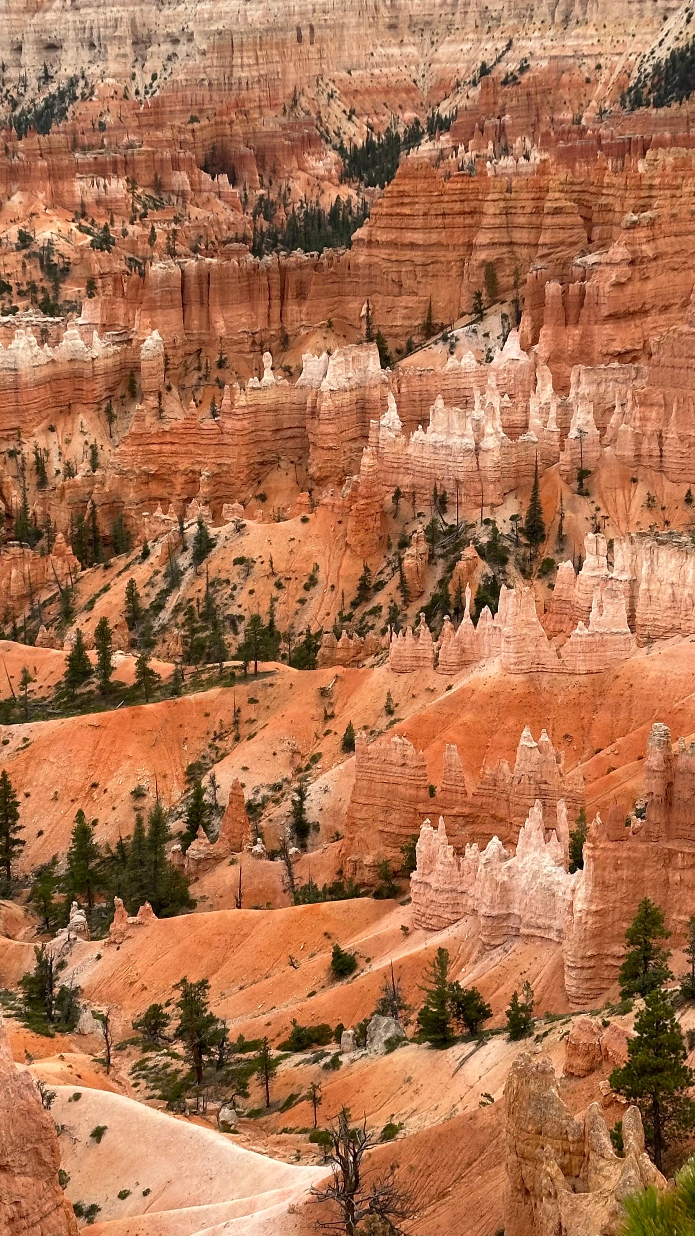
Best Bryce Canyon Tours: Scenic, Guided Hikes, Stargazing
Top-rated tours including the 4.9-star scenic van tour, guided Navajo Loop hike, and horseback rides.
Read more →Bryce Canyon from Las Vegas: Full Day Trip Guide
How to make the 270-mile drive, the best stops on Highway 12, and whether to stay overnight.
Read more →
Written by Diego Fresno, Travel writer and independent publisher specialising in the American Southwest. Latest research conducted on location in Page, Arizona during July 2025. Guides are verified quarterly — last review April 2026.. Verified quarterly: last review April 2026. About the author →