Goosenecks State Park is a canyon overlook in southern Utah where the San Juan River drops a thousand feet into the earth and then loops on itself so dramatically that it travels six miles of river to advance just one and a half miles north. The result is one of the most geologically extreme views on the Colorado Plateau: a series of three interlocking meanders carved a quarter of a billion years into the desert floor. The visit takes 15 to 30 minutes. The park is 35 minutes from Monument Valley and about an hour and a half from Page, Arizona.
Location
Mexican Hat, UT (UT-316 off US-163)
Entry fee
$5/vehicle (cash or card)
Hours
Daily, dawn to dusk
Time needed
15-30 min (overlook)
Canyon depth
~1,000 ft
Camping
8 rim sites, $10/night, first-come
From Monument Valley
35 miles / 35 min
From Page, AZ
80 miles / 1h 20min
What are the Goosenecks?
The Goosenecks of the San Juan River are a textbook example of an entrenched meander: a river pattern that formed on a flat floodplain, then held its sinuous shape as the surrounding plateau slowly rose over millions of years and the river cut deeper and deeper into the rock rather than straightening out. The result is a canyon that is roughly 1,000 feet deep and only a few hundred feet wide at the bottom, with the river looping back and forth through it for six miles while gaining barely one and a half miles of northward progress.
The formation is sometimes called the "Goosenecks of the San Juan" or simply "The Goosenecks." Geologists use it as a reference example in textbooks because the entrenched meander pattern is so unusually clear and complete. The rock exposed in the canyon walls spans roughly 300 million years of sedimentary history, from the Pennsylvanian limestone at river level to the Cedar Mesa Sandstone at the rim.
For practical purposes: you pull into a paved parking lot at the rim, walk 100 feet to the edge, and look down 1,000 feet at a river making a shape that looks like it belongs in an optical illusion. Then you drive back to US-163 and continue to Monument Valley or Valley of the Gods.
Entry fee and hours
Entry is $5 per vehicle, paid at a staffed booth at the park entrance. A single vehicle fee covers all passengers up to 8 people. Tour groups arriving by bus pay $2 per person. The America the Beautiful annual pass is not accepted here because Goosenecks is a Utah State Park, not a federal site managed by the National Park Service.
The park is open daily from dawn to dusk. There is no timed-entry reservation system and no permit requirement. Parking at the rim is free once inside. In practice, there is almost never a queue at the entrance booth, even on weekends.
How to get there
The park entrance is on UT-316, a paved spur road that turns west from US-163 about two miles north of Mexican Hat. The turnoff is well signed. From the highway to the parking lot is about four miles, all paved.
From Monument Valley
Drive north on US-163 from the Monument Valley Navajo Tribal Park visitor center. The distance is about 35 miles and takes 35 to 40 minutes. The UT-316 turnoff appears on the left shortly after passing through Mexican Hat.
From Page, Arizona
Take US-89 east from Page to US-160, then US-160 east to US-163. Turn north on US-163 and continue about 20 miles to the UT-316 turnoff. Total distance is roughly 80 miles and takes about 1 hour 20 minutes.
From Las Vegas
The most common route is I-15 north to US-89 north through Kanab, then US-89 east to Marble Canyon, then US-89A and US-163 to Mexican Hat. The drive is approximately 315 miles and takes around 4 hours 30 minutes without stops. Most travelers doing this route combine Goosenecks with Monument Valley, Page, and Antelope Canyon over two or three days.
From Moab
Drive south on US-191 to Blanding, then take US-163 south to Mexican Hat and continue to the UT-316 turnoff. About 115 miles and 2 hours 15 minutes. Goosenecks works naturally as an add-on to a Moab trip heading south toward Monument Valley.
What to see at the overlook
There is one feature inside the park: the canyon rim overlook. From the parking lot, a short paved path leads to a railing at the edge of the mesa. The view is the entire reason for the park's existence: the San Juan River visible in three distinct loops below, with canyon walls dropping vertically on all sides.
Unlike Horseshoe Bend in Page, which attracts roughly 2 million visitors a year, Goosenecks sees a fraction of that traffic. On most days you share the rim with a few dozen people at most. There is no guardrail on all sections of the edge, so take care with children and with stepping backward for photographs.
There is no visitor center, no interpretive exhibits inside the park, no food or water (bring your own), and no cell service. The pit toilets near the parking lot are generally maintained but basic.
Honaker Trail
The Honaker Trail is a 5-mile out-and-back hike that descends 1,500 feet to the San Juan River at the bottom of the canyon. The trailhead is not inside Goosenecks State Park: it is about 3 miles west of the park entrance on UT-316, at a separate access road that requires a high-clearance vehicle. The hike itself is free.
The trail was built in 1893 to give gold miners access to placer deposits along the river. It follows a series of steep switchbacks on exposed ledges, with some sections requiring hands-on scrambling. The round-trip takes 4 to 6 hours for most hikers. Bring at least 4 liters of water per person: the canyon bottom is significantly hotter than the rim, and there is no shade on the descent. Best done in spring or fall, not in summer heat.
If you are visiting from the main park overlook and wondering whether to do the Honaker Trail the same day: only consider it if you arrived early, have the right vehicle for the access road, and are in strong hiking shape. It is a serious hike, not a nature walk.
Camping on the rim
Goosenecks State Park has 8 primitive campsites, all positioned along the canyon rim. Sites cost $10 per night, paid at the entrance booth, and are strictly first-come first-served with no advance reservations. Each site has a fire ring and a picnic table. Pit toilets are shared and located near the overlook.
There is no potable water anywhere in the park. Bring everything you need. The nearest place to refill water is Mexican Hat (10 minutes east on US-163).
The rim location makes this one of the better dark-sky camping sites in southern Utah. On a clear night, the Milky Way is visible and the river is a faint silver ribbon 1,000 feet below. In summer, nights cool quickly once the sun drops behind the mesa. In spring and fall, temperatures can dip to near freezing after midnight even when daytime highs are comfortable.
If the 8 rim sites are full, Valley of the Gods (15 minutes west) offers dispersed BLM camping with no fee and no limit on sites.
Best time to visit
Spring (April to May) and fall (September to October) are the best seasons. Temperatures are mild (60 to 80°F during the day), the light is warm, and crowd levels are minimal. The overlook faces generally west, so late afternoon light hits the canyon walls directly and produces the deepest color on the red rock.
Summer is hot but manageable for a short overlook visit: you are only outside for 15 to 30 minutes. The Honaker Trail, however, should not be attempted in summer heat. Winter brings occasional snow and ice, which can make the approach road to the park entrance slippery but rarely impassable. The park stays open year-round.
For photography: morning gives you soft directional light from the east that catches the canyon walls opposite the sun. Afternoon gives more dramatic color on the west-facing walls as the sun drops. The canyon is deep enough that midday direct overhead light washes out the textures.
Combining Goosenecks with Monument Valley
Goosenecks and Monument Valley are 35 miles apart on the same road (US-163) and make a natural half-day or full-day combination. The most common itinerary runs:
- Morning, Goosenecks: arrive by 8 or 9 am for the best canyon light, spend 30 minutes at the overlook.
- Late morning, Valley of the Gods: drive 15 minutes west on UT-143 for the scenic 17-mile loop through the sandstone buttes (free, no fee). Allow 2 to 3 hours.
- Afternoon, Monument Valley: drive south on US-163 to arrive in time for the 2 or 3 pm jeep tour, which runs through the restricted areas of the Navajo Tribal Park and typically ends around sunset.
If you are skipping Valley of the Gods, you can easily fit Goosenecks and a Monument Valley jeep tour into a single morning-to-afternoon day and still be back in Page by early evening.
Goosenecks itself has no guided tours. Monument Valley, 35 minutes south, is where Navajo-operated jeep tours take you into the restricted areas of the Tribal Park that are off-limits on the self-drive Valley Drive. If you are combining both stops in a day, book the jeep tour for the afternoon slot so you arrive at Goosenecks at opening.
Monument Valley: 3-Hour Navajo Spirit Group Tour
Open-top 4x4 jeep tour covering all major formations: Mitten Buttes, Merrick Butte, Three Sisters, and John Ford's Point. Entry fee included. Free cancellation.
Monument Valley: 3-Hour Scenic Express Tour
Covers all major viewpoints at an unhurried pace. Most-reviewed Monument Valley tour on Viator. Free cancellation.
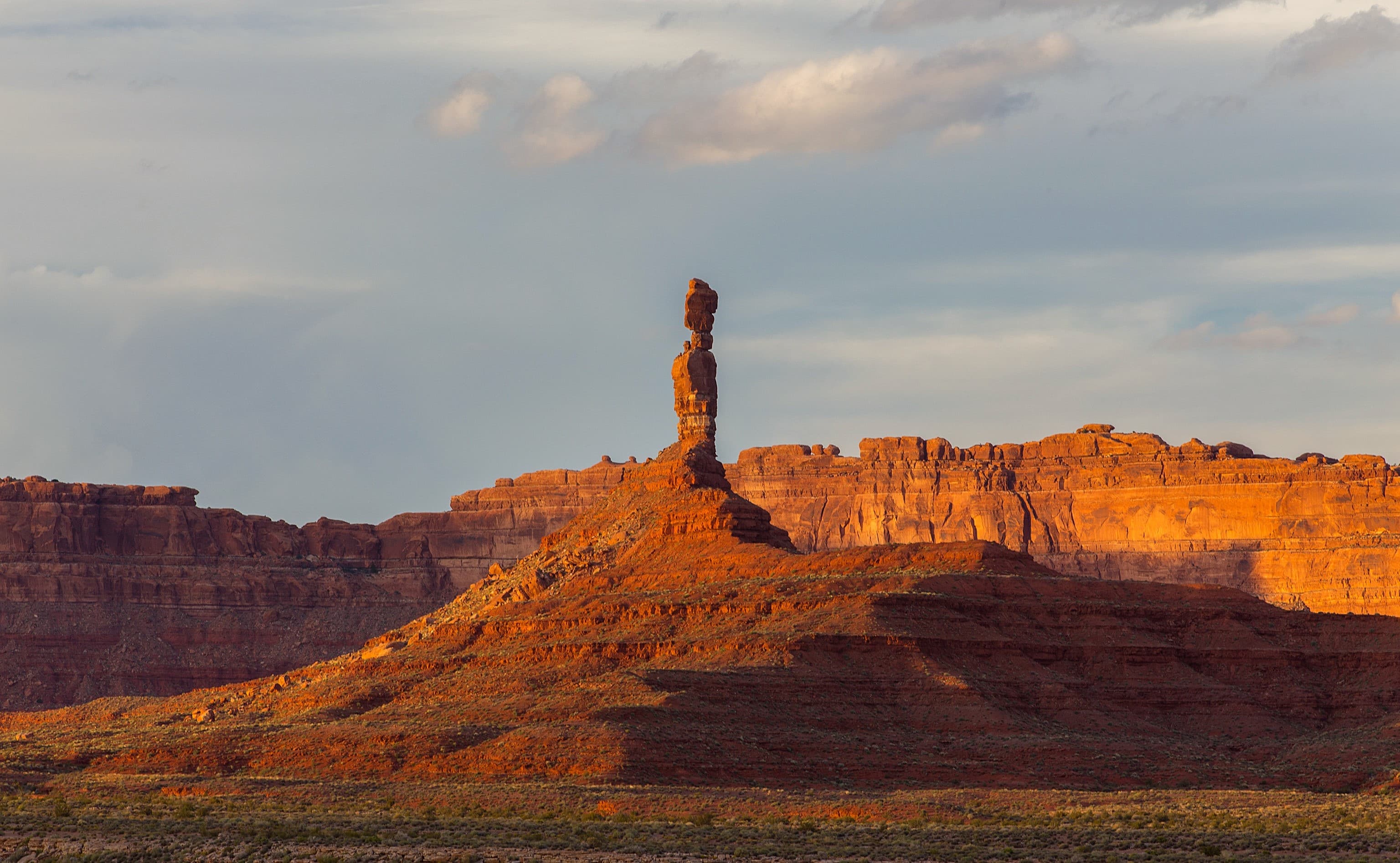
Valley of the Gods scenic drive guide
The free 17-mile loop through sandstone buttes 15 minutes from Goosenecks. Same landscape as Monument Valley, no entry fee, almost no crowds.
Read more →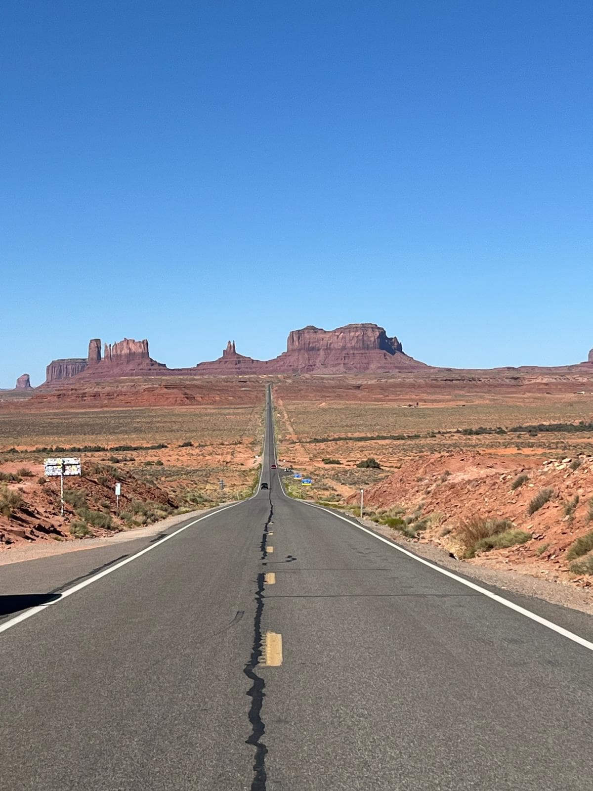
Monument Valley complete visitor guide
Navajo Tribal Park 35 minutes south. Entry $10/person plus $15/vehicle. Jeep tours, sunrise and sunset spots, The View Hotel.
Read more →Where is Goosenecks State Park?
Goosenecks State Park is in San Juan County, Utah, about 10 miles west of the small town of Mexican Hat. The access road is UT-316, which turns west off US-163. The park sits on the rim of a 1,000-foot canyon carved by the San Juan River, close to the Utah-Arizona border. The nearest large city is Moab (about 2.5 hours north via US-191).
Is Goosenecks State Park worth visiting?
Yes, if you are already heading to or from Monument Valley. The overlook takes 15 to 30 minutes and requires almost no effort: you drive to the rim parking lot and walk 100 feet to the edge. The canyon view is genuinely striking and unlike anything else on the Colorado Plateau. The $5 entry fee is the lowest of any developed overlook in the region. The main reason to skip it is a very tight schedule, since there is nothing to do beyond looking at the view (and, for the fit and well-equipped, the Honaker Trail).
How much does Goosenecks State Park cost to enter?
The entry fee is $5 per vehicle, paid at the staffed entrance booth. A single vehicle entry covers up to 8 passengers. Tour bus passengers pay $2 per person. The America the Beautiful National Parks pass is not accepted here, since Goosenecks is a Utah State Park, not a federal site. Cash and cards are both accepted at the booth.
How long should you spend at Goosenecks State Park?
Most visitors spend 15 to 30 minutes. The park is essentially one overlook: a paved parking lot, a short walk to the canyon rim, and the view. There are no established trails inside the park and no visitor center. If you are a photographer or want to watch the light change, plan 45 to 60 minutes. Campers staying overnight obviously stay longer, and hikers doing the Honaker Trail (outside the park boundary) should budget a full half-day.
Can you camp at Goosenecks State Park?
Yes. The park has 8 primitive campsites along the canyon rim, all first-come first-served with no advance reservations. Sites cost $10 per night, paid at the entrance. Each site has a fire ring and picnic table. There are pit toilets near the overlook, but no potable water anywhere in the park. Bring all your own water. The rim location means you can watch stars reflect on the river 1,000 feet below, which is one of the more unusual camping experiences in Utah.
How far is Goosenecks State Park from Monument Valley?
About 35 miles and 35 to 40 minutes by road. From Goosenecks, drive south on UT-316 back to US-163, then continue south into Arizona to the Monument Valley Navajo Tribal Park visitor center. The two stops work well together in a single day: Goosenecks in the morning, then Monument Valley for the afternoon jeep tour and sunset on The Mittens.
Is Goosenecks like Horseshoe Bend?
The geology is similar: both are incised meanders where a river carved a deep loop into the Colorado Plateau. The main differences are scale and setting. Horseshoe Bend is a single 270-degree loop dropping about 1,000 feet to the Colorado River. Goosenecks is a series of three interlocking loops over a 6-mile stretch of the San Juan River, with a canyon that is also around 1,000 feet deep. Horseshoe Bend gets roughly 2 million visitors a year. Goosenecks gets a small fraction of that and feels remote and quiet by comparison.
Is there hiking at Goosenecks State Park?
Inside the park there are no established trails beyond the short walk from the parking lot to the rim overlook. The Honaker Trail is a separate trailhead about 3 miles west of the main park entrance on UT-316. It is a strenuous 5-mile out-and-back hike that drops 1,500 feet to the San Juan River along an exposed switchback route. The trail was originally built in 1893 for mining access. A high-clearance vehicle is needed to reach the Honaker trailhead, and the hike itself requires sturdy footwear, plenty of water, and some scrambling experience.
What is the difference between Goosenecks State Park and Valley of the Gods?
They are two completely different experiences near Mexican Hat, separated by about 15 minutes of driving. Goosenecks is a canyon overlook: you park and look down 1,000 feet into a river gorge. Valley of the Gods is a 17-mile scenic driving loop through sandstone buttes on the plateau above. Valley of the Gods is free (no entry fee). Goosenecks charges $5. Combining both in a single morning, then continuing south to Monument Valley in the afternoon, is one of the best day itineraries in the San Juan County area.
Written by Diego Fresno, Travel writer and independent publisher specialising in the American Southwest. Latest research conducted on location in Page, Arizona during July 2025. Guides are verified quarterly; last review April 2026.. Verified quarterly: last review April 2026. About the author →